Featured Photo: Native Colors

Featured Photo: Native Colors
Showing posts with label Hiking. Show all posts

Sunday, February 07, 2021

Glacier Day Five: Hiking to Sperry Glacier Part Two

After we had a nice lunch break on our Sperry Glacier hike, it was time to hit the trail again. We still needed to climb a bit higher to get to Comeau Pass and Sperry Glacier beyond. The daylight would get away from us if we didn't keep moving. Not only did we need to still reach the glacier, we also had a long return hike ahead of us. 

As we were wrapping up lunch, I noticed a large clump of flowers overlooking Akaiyan Lake. Since I had my pack open already for lunch, it was easy to grab my camera and take a picture. As with many of the other flowers I encountered in Glacier National Park, I'm still having a hard time with identification. That said, I believe this one is rocky ledge penstemon. If anyone has any better identification, please let me know!


Rocky Ledge Penstemon above Lake Akaiyan

The next wildflower was one I recognized without the need for an identification guide. Spring beauty is a wildflower we have here in Tennessee. In fact, I even have them in my yard. They are one of the earliest wildflowers in the spring around here, so I was surprised to find them still blooming at the end of July here in Glacier National Park. Of course, with the huge snow fields everywhere and a large glacier lurking just over the pass, the wildflowers probably still thought it was early spring. 

Spring beauty along the Sperry Lake trail above Akaiyan Lake

Shortly above our lunch stop, the trail reached yet another bench that followed the headwall above Akaiyan Lake towards the base of Gunsight Mountain. At the far end of the bench, the trail turned and started a series of switchbacks up to Comeau Pass. We were getting close. 

At this point, both of us had our cameras out. The scenery was the same that we had enjoyed during lunch, but the perspective was constantly shifting as we moved along. Our cameras were kept busy with the occasional wildlife as well. We both enjoy the marmots, ground squirrels, and other critters. My wife stalked a marmot while I found a willing golden mantled grand squirrel. 

Photographing a marmot along the Sperry Lake trail

Golden mantled ground squirrel along the Sperry Lake trail near Sperry Glacier

Oh, and we didn't forget to photograph the views either. 

Headwall above Akaiyan Lake on Sperry Lake trail

Akaiyan Lake view on Sperry Lake trail near Sperry Glacier


Speaking of wildlife, if you haven't read about the mountain goat, go back and do so now. This was one of the hiking highlights of Glacier National Park for both of us but especially for my wife. Here is a teaser picture of the goat along with the story. 

The Goat on the Trail to Sperry Glacier


Sperry Lake trail to Sperry Glacier Mountain goat

After the mountain goat encounter, we were excited for the final push up to Comeau Pass and Sperry Glacier beyond. The trail finally turned and made a beeline to a gash in the final headwall below the pass. This passage has been vastly improved by the park service with some stairs cut into the rock to make climbing easier. It is a little sketchy, but overall not a bad final climb to breathtaking Comeau Pass. When we got to the top, the views were incredible. The Sperry Glacier was lurking out of sight, however. With a bit of research, I found this interesting comparison of what it looked like back in the 1930s with today. Unfortunately, Sperry Glacier has retreated a LOT since then. 

Here is the view towards Sperry Glacier from Comeau Pass. Note the mountain goat in the lower left side of the first picture. This mountain goat came up the stairs just after we did and continued on across the landscape. The bulk of Gunsight Mountain is just out of view to the right. 

Looking towards Sperry Glacier from Comeau Pass

This second view from Comeau Pass is looking generally west towards Edwards Mountain. There were still huge snowfields, probably semi-permanent. You can see the rugged layers in the rock that makes up Edwards Mountain. The geology here in Glacier National Park was incredible.

Edwards Mountain from Comeau Pass

After gaining the pass and pausing for a few pictures, we pushed on towards Sperry Glacier itself. This was our main objective after all. The trail crossed rocks and many large snowfields. We had to be a bit careful on some of the snow bridges. Streams were running underneath and we didn't want to have one collapse and dump us into the icy water. All of this water was rushing downhill towards Avalanche Lake for the most part. 

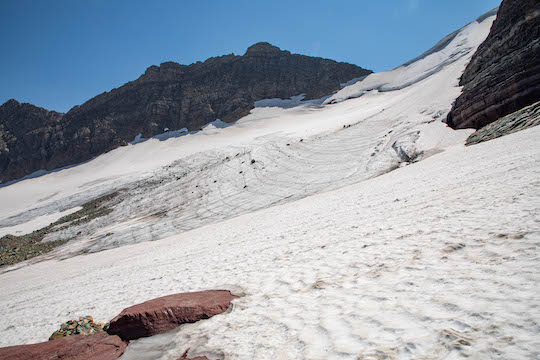
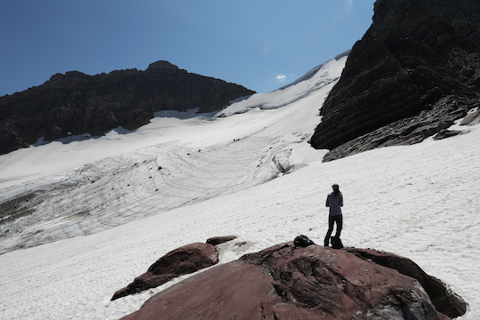
Finally, after what seemed much farther than we anticipated, Sperry Glacier finally came into view. We simply stood still and took it all in before remembering to snap a few pictures as well. We felt incredibly fortunate to be able to experience this place while a glacier is still present. At the rate things are going, this opportunity won't last long so see it soon while you can.

Sperry Glacier

My wife in front of Sperry Glacier

Sperry Glacier Panorama

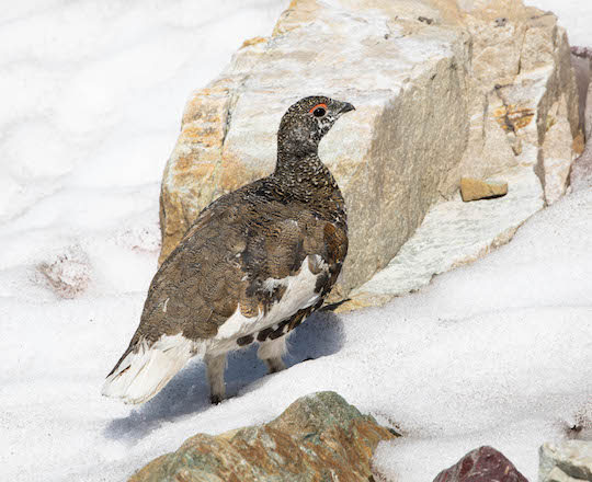
We were getting low on water at this point and decided to filter some water from the glacial runoff before heading too far back towards Comeau Pass and the trail downhill. As we were heading that general direction, we had a couple more awesome wildlife encounters. The first happened as I came over a jumbled pile of boulders and stepped down. Out on the white snow, something moved. I quickly froze and realized I had almost run over a ptarmigan. Since I love birds, this was a big treat. I'm not a hard core birder, but I do enjoy seeing new to me species. This was one that I hadn't found when I lived in Colorado or on any other trips out west. I quickly switched out lenses on my camera and thankfully the bird didn't run off too fast. Here are a couple of pictures. 

Ptarmigan near Sperry Glacier in Glacier National Park

Ptarmigan near Sperry Glacier

The second encounter was better for my wife. We saw a good sized group of mountain goats resting on the snowfields below Gunsight Mountain. My wife decided to move in for a closer look and better pictures. I'll share her post so you can see her pictures if and when she gets around to it, but the neat thing about this group is that it had a big billy goat. When I say big, he made all the other goats look small.

After these two wildlife encounters, we decided it was time to make haste. According to my wife's watch, we were over 10 miles for the day and still had nearly that to get back to the car. Our extra wandering around to see things was adding up to a big day.

On the trail down, we got serious about walking. Both of us put our cameras up and got our trekking poles back out. The trekking poles are really useful for when you have big elevation changes up or down. On the downhill, they really take a lot of the pressure off of your knees. This was what I had brought them for. I can do uphill although on this day I had struggled a bit with the heavy cardio. The downhill usually gets my knees aching, though, and we had a lot of trip left. I didn't want to get gimpy now!

Back down the trail a ways, we ran into some more mountain goats. These things are everywhere but it takes at least some luck to cross paths with them. These were pawing and eating at the trail itself. Apparently, the goats like to eat the minerals and salts from where people urinate. Yep, the goats eat pee or at least the remnants of it. This is a really good reason to do your business on durable surfaces. There were huge gaping holes in the trail where the goats had pawed and otherwise dug into the trail to get at the minerals. Regardless of why they were there, the goats did offer some good photo opportunities and we dug our cameras back out. 


After this, the wildflowers were distracting, but I was getting tired enough that I didn't bother to photograph any until we stopped for water. At that point, there was a clump of some of my favorites, the purple monkey flowers. I snapped a picture, filtered water, and then we kept trucking on down the long trail back.

Purple monkey flowers along the Sperry Lake trail

From that break on, we really made haste. The miles flew by on increasingly tired feet. We were both starting to look forward to the end of the hike, something that doesn't happen too often. Thankfully, nature had one more surprise to perk us up. We were on the steep downhill section just above Lake McDonald. As we came around one switchback, we noticed a deer. Seriously, normally we wouldn't be too excited about deer, but we hadn't been seeing tons of larger wildlife on this trip. This was another photo opportunity that couldn't be missed. This curious buck was not worried about us in the least.

After this picture, we quickly finished our hike and were back to the car ready to go back to camp and rest. According to my wife's watch, including our small side trips for different things, we had put in a little over 20 miles. This was a new record for each of us. We have been close but never broke 20 miles in the Smokies. We were tired but also very satisfied from a day well spent in the most glorious surroundings. 

In many ways, day five was the pinnacle of our trip to Glacier National Park. This was our longest hike for the trip and also one of my favorites. The only hike that came close was our last day in Glacier, but I'll save that for another day. 

Monday, January 25, 2021

Glacier Day Five: Hiking to Sperry Glacier Part One

The adventure for day five had started months earlier. When planning our trip to Glacier National Park, I had planned on doing several hikes. A large portion of these hikes were impossible due to the closure of the Many Glacier area of the Park. Thus having jettisoned many of our plans, we had been developing a game plan as we went. So far, we had already experienced several amazing hikes in Glacier National Park, but we were ready for more than the usual short popular routes like Avalanche Lake or Hidden Lake. Our longest day at this point was almost ten miles but our legs were feeling fresh and we were ready to go. It was time to get back to some of my original plans.

Sperry Glacier is one of the more accessible glaciers in Glacier National Park, provided of course that you are willing to walk the nearly ten miles up there to see it. With everything going on because of COVID, I did not even look into any of the backcountry chalets in the Park. If I ever have it to do again, however, I would definitely explore the possibility of spending a night or two at the Sperry Chalet. This enables you to more comfortably explore the Sperry Glacier vicinity and also maybe take a walk over the pass to Lake Ellen Wilson which is rumored to harbor some very nice brook trout. 

The Big Hike

On our trip, we were looking at doing the nearly twenty mile hike as a day trip. Thus, it was time for another early start. We got going even earlier than any other day and were well up the trail by the time the sun started breaking over the ridges. Walking the Gunsight Pass trail uphill from Lake McDonald, we started out on the same route that had taken us to Snyder Lake just a few days before. As on the hike to Snyder Lake, we pushed hard through the first miles. The steep section just above Lake McDonald flew by and we were soon on new to us trail. 

The Gunsight Pass trail generally follows Sprague Creek starting just a little beyond the Snyder Creek crossing. In the early morning air, sound travelled well and we usually heard other hikers ahead before actually spotting them. Sprague Creek was down in a little canyon to our right as we hiked. The surrounding landscape opened up more and more. The landscape throughout this portion of the hike was affected by the Sprague Fire, meaning if you hike during the midday hours, be prepared for lots of sun exposure. I was starting to get a little winded by the time we approached Beaver Medicine Falls, but my wife was just starting to get warmed up. Interestingly, on this day, she was easily the stronger hiker and I struggled a little. Some days you have it while other days you don't. On this day, I had to push harder than I normally do during a hike.

Hiking to Sperry Chalet, Almost

The trail was fairly congested with hikers heading up to Sperry Chalet. Thus, resting always brought the awkward problem of potentially being passed by hikers that you knew you would fly by again shortly. Our rest breaks were accordingly very short, just enough time to swig some water in fact. I would catch my breath while my lovely wife waited on me, and then away we would go again. Just above Beaver Medicine Falls, the trail begins to switchback on the final push up to the junction of the Gunsight Pass and Sperry Lake trails. The trail never gets close enough to Beaver Medicine Falls for good pictures, but I was enjoying the wildflowers that were growing in ever greater numbers the higher we went. They gave me an excuse to slow down albeit briefly. I was sticking with cellphone pictures at this point. We had a long enough day that I didn't want to get slowed down with my big camera quite yet.

I was having a difficult time not only with the hike, but also identifying flowers. Some of these I'm still trying to figure out. Both of the flowers in the two shots below are in the penstemon family but beyond that I'm not certain. If you have any ideas I would like to hear about them!


We began to spot a famous Glacier National Park wildflower as well. Bear-grass is a spectacularly beautiful wildflower that can be abundant in parts of Glacier. Because this flower does not bloom every year, it can be hit or miss to find even if the overall distribution is fairly widespread. We noticed a few blooming, but most were not particularly close to the trail. As we ascended into the subalpine and then alpine habitats, we were increasingly careful to try and stick to the trail as far as possible. These are fragile environments, and I strongly recommend sticking to trails in this type of terrain to limit the impact on these beautiful places. Eventually, we did find a few blooming close enough to the trail that I was able to get some shots without trampling everywhere. 

Bear grass blooming on the trail to Sperry Glacier

Sperry Lake Trail Through Glacier Basin

Thankfully, we would see this one again on future hikes, so there were more opportunities for pictures. After snapping just a few, we were again on the move. The sun was still behind the great bulk of Gunsight Mountain to our east and northeast as we ascended through Glacier Basin. The shade was a welcome reprieve from what we knew would be intense sun later in the day. It also left us with some interesting lighting as the rich morning light reflected through the valley below.

Glacier Basin viewed from the Sperry Lake Trail

Morning light in Glacier Basin hiking on the Sperry Lake Trail


We were soon winding up towards a rushing torrent that had a small metal footbridge to help us cross. Feather Woman Falls just above the creek crossing provided beautiful views as we hiked this section.

Looking up towards Feather Woman Falls

Metal Bridge over Sprague Creek below Feather Woman Falls

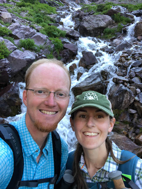
Selfie below Feather Woman Falls on the Sperry Lake Trail to Sperry Glacier


Just beyond this stream crossing, we began to encounter more and more wildflowers. One of my absolute favorites from this whole trip was the yellow Columbine. Here we began to find these flowers in good numbers. I took a picture or two on my cellphone and then finally caved in. My "good" camera had been riding securely in my backpack all morning. I knew if I didn't take it out now, then I probably wouldn't. If I was going to carry all that weight up the mountain and back down, then I was going to use the camera. The first picture is from a cellphone, while the others are from the good camera. This first one was particularly amazing because of the color variation it exhibited. The others were more standard yellow as one would expect. 

Incredibly colorful yellow columbine


Yellow Columbine in Glacier Basin on the trail to Sperry Glacier

Yellow Columbine closeup along the trail to Sperry Glacier

As the trail wound around the headwall of Glacier Basin, it soon emerged into the morning sunlight along the flanks of Edwards Mountain. An intense climb commenced and we quickly gained elevation as we approached Akaiyan Falls. This section of trail reminded me of the Devil's Corkscrew on the Bright Angel Trail in the Grand Canyon. Looking back, I was impressed with myself for making such good time through this section! I was finally starting to feel better and the workout had me warmed up. 

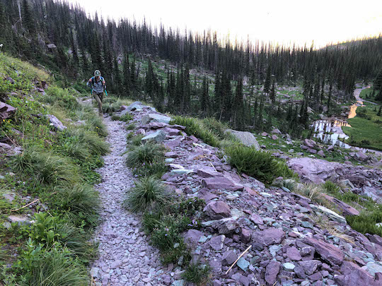
Steep switchbacks on the Sperry Lake Trail

Of course, we had to take some pictures of Akaiyan Falls also. This falls is a series of plunges coming down from The portion we photographed was one of several plunges. This was one of the shorter plunges. This falls is basically a section of big drops below Feather Woman Lake and plunging down into Glacier Basin. The trail crosses the lower end of these cascades along the headwall of Glacier Basin and again approaches the upper portions below Feather Woman Lake. 

Upper reaches of Akaiyan Falls below Feather Woman Lake


A Lunch Spot With A View

About this time, I began to think about lunch. When we are on these big adventures and burning lots of calories, I tend to think about food more than usual. Those who know me know that I already like food a lot. It was only 10:30 am local time, but we began to discuss eating an early lunch. Now we just needed to find the right spot.

The switchbacks continued up and we began winding around past Feather Woman Lake and then began climbing yet again. The trail covers flat basins with short steep sections at the head of each one. The bottom was Glacier Basin. The next contains Feather Woman Lake, and the last contains Akaiyan Lake. Above Akaiyan Lake, we would find another bench just below the final climb to Comeau Pass.

Large snowfields began to block our progress between Feather Woman and Akaiyan Lakes. The trekking poles we had brought were finally put to good use. Thankfully, the snow wasn't too slick. The strong summer sun had created a layer of slush on top, but if you stepped carefully, hiking was mostly safe. Finally, as we passed yet another big snowfield, some large boulders beside the trail overlooking Akaiyan Lake required a stop. We had found a lunch spot with a view. 

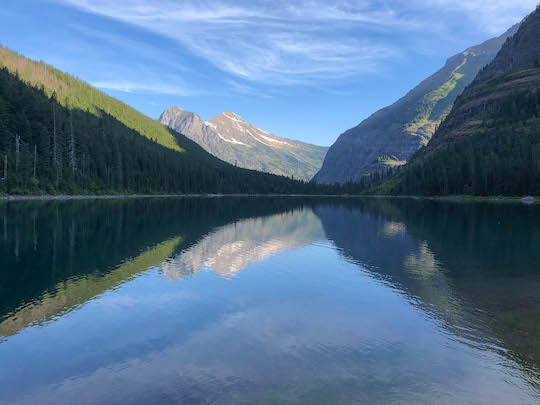
Akaiyan Lake and Feather Woman Lake in Glacier National Park

Sperry Glacier Trail Feather Woman Lake and Akaiyan Lake in Glacier National Park


Sperry Lake Trail Akaiyan Lake and Feather Woman Lake

Seriously, a lunch spot doesn't get any better than this. We took an early lunch around 11:00 am local time. This is about our usual practice, especially on such big hikes. The energy from lunch would help push us up over Comeau Pass and on to Sperry Glacier we hoped. That is a story I'll save for another day...

Enjoy the rest of this hike with these two stories.


Tuesday, January 12, 2021

Glacier Day Four: Hiking to Avalanche Lake and Going Back to Polebridge

This was our last short day before we attempted a big hike. When I say short, some people might disagree as we put about 7 miles on our boots. We were starting to get in a good hiking rhythm, though, and were about ready for much bigger things. To obtain parking, we did our usual early start and caught yet another amazing sunrise. Probably we should have been up another hour earlier and tried to catch the sunrise from Logan Pass, but getting up at 5:00 am seemed reasonably early to both of us but 4:00 am not so much.

Glacier National Park Sunrise on the way to Avalanche Lake


Parking and Hiking to Avalanche Lake

As we approached the Avalanche Lake parking area, I could see tons of vehicles already there. Glancing back in the "exit" from the main parking area to the left,  I noticed a couple of parking spots. Ignoring what appeared to be full parking ahead and to the right, I quickly swung in and drove around. Coming around the curve in the parking area close to McDonald Creek, I spotted a couple of parking spots still available! We quickly grabbed one. Almost immediately, someone else grabbed the other one. As we ate our breakfast, other cars took up the circling routine like hungry vultures. We had yet again barely made it. 

The trail begins across the road from the main parking area. We quickly got across and entered one of the most beautiful cedar groves we saw in Glacier. This portion of the trail is absolutely enchanting. Before long, the trail reached the hillside. Gushing out from a small canyon was Avalanche Creek which the trail roughly follows all the way to the lake. The stream stays out of sight much of the time. However, at the beginning of the climb, it gets close to the little slot canyon where the stream pours out into the flat cedar grove just above McDonald Creek.

Avalanche Creek slot canyon


If the Hidden Lake Trail was the busiest we hiked, this one was not noticeably behind. People were everywhere. As this was a narrower trail, people were being just a little funny about COVID. We tried to be careful and stay respectful which is tricky when your hiking pace is significantly faster than probably 98% of the other hikers. Thankfully, everyone else was being nice as well, and soon we were finally approaching the lake.

Avalanche Lake in Glacier National Park

Avalanche Lake is stunningly beautiful. The glacial snowmelt contributes to one of the most incredible colors I've seen anywhere. I've been trying to decide what color this is, but so far I don't have a good description. Maybe I need to buy a box of Crayola crayons to help. What color do you see peeking through the trees here?

Avalanche Lake color

The trail basically runs into the bottom end of the lake. We stumbled out amongst the rocks and boulders just like everyone else. The sun was rising higher and threatening to burst over the ridges at the head of the lake. The perfectly calm lake surface produced a remarkable mirror effect. The surrounding hillsides and waterfalls were reproduced in the tranquil lake surface. 

Avalanche Lake mirror effect

At this point in our hike, I actually wished we had gotten an earlier start. This didn't happen often during our time in Glacier. However, the lighting, while dramatic, would have been better much earlier before the sun started striking the opposite ridges. If I ever have this to do again, I would like to hike both earlier and later when the sun is straight overhead. There are different advantages to each light situation and we enjoyed the one we were gifted with to the utmost. As the sun continued to creep closer and closer to cresting the ridge, dazzling shafts of sunlight moved ever lower down the ridges and evergreens. 

Morning hiking at Avalanche Lake

Eventually, we worked our way all the way to the head of the lake and took in the views looking back the other way.

Looking down Avalanche Lake from the head

Hiking Avalanche Lake selfie

At this point, I came close to fishing a bit. As you'll recall from adventures of previous days, I was carrying a Tenkara rod with me on most of our hikes. You just never know what you might find. There were occasional fish rising, and I was itching to catch some more cutthroat. These beautiful fish are always a treat since we don't have them in Tennessee. Unfortunately, it was not to be on this particular hike. We had ample time, but the fish were rising just a little too far out. Thus the limitations of Tenkara eventually came back to haunt me. I still greatly enjoy fishing this way, but at least once on our trip, I wished I had carried a regular fly rod.

We were enjoying the lake, but decided to try and get some more done on this day. We had a lot of exploring that we could still do in the Polebridge vicinity so we started back down the trail. One last selfie was in order as the sun finally burst over the ridge. 

Avalanche Lake morning rays

Down at the bottom, we wandered through the cedar grove and stopped long enough for a picture of Avalanche Creek. The colors of the rocks and water were almost like a painting. 

Avalanche Creek colorful rocks

When we got back near the car, we discovered something interesting. At this point in our visit to Glacier National Park, we were getting serious about keeping track of our hiking mileage. We were still a 1/4 mile short of seven miles and were wanting to push the numbers up a little. Instead of getting in and leaving immediately, we instead wandered down to McDonald Creek and took in the scenery there. A little walking up and down the shoreline along with taking some pictures increased our total mileage to just over seven miles for the day. 

My wife was keeping meticulous record of our distances with her Garmin Forerunner 235. I was starting to get into the spirit of things and wanted to see how far we could push our total mileage. After four days, we were sitting at 24.08 miles. We needed to seriously pick up the pace if we wanted to hit any big numbers. The next day was the first push for big miles. Our legs were feeling fresh and ready to go.

Back to Polebridge and Visiting Bowman Lake

We were beginning to enjoy our daily drives up to Polebridge. While I wasn't getting anymore fishing in up there, I knew it was available if the urge struck. There were still lots of places to explore, however, and we were wanting to see what we could find. When we reached the Polebridge entrance, we pulled up to the small entrance station and were surprised to find it occupied. The ranger there was nice and advised us that we probably couldn't make it to Kintla Lake but that Bowman Lake would probably work with our Toyota Corolla. Naturally, we headed towards Kintla Lake. 

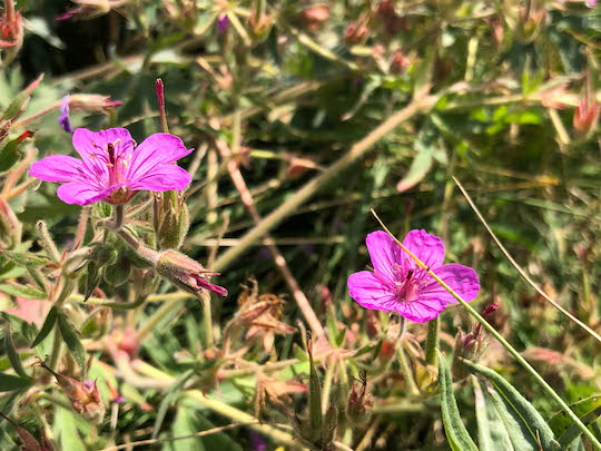
Our assumption was that the ranger was probably recommending Bowman Lake to all visitors, so perhaps there would be more wildlife towards Kintla. If and when the road got too bad, we would just turn around. We never did figure out if our assumption was bad or if there were just a lot of visitors. Either way, we hadn't made more than a couple of miles before deciding to turn around. There was a ton of traffic and we assumed that it would scare off any wildlife that might have been otherwise around. We did find a few wildflowers including the harebells (first picture) and sticky purple geranium (second picture) below. There were also nice views of the distant mountains, but otherwise this was a wasted drive.

Harebells in Glacier National Park

Stick Purple Geranium in Glacier National Park


The turnoff to Bowman Lake was back near Polebridge and we decided to try and make the drive. Our little car was great for gas mileage, but the rough roads made me slightly uneasy. In my younger days, I've taken sedans down some truly ridiculous jeep trails roads. However, we were in my wife's car, and I didn't want to mess it up too badly. The road to Bowman Lake wasn't bad thankfully. There were a few rough spots, but nothing that simply slowing down wouldn't help. We arrived at the lake and quickly found parking before strolling down to the shoreline. 
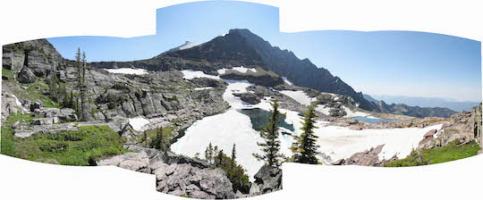
Bowman Lake near Polebridge in Glacier National Park


Like most of the west side lower elevation lakes, Bowman was huge with the headwaters back near the mountains of Glacier National Park. We briefly contemplated a hike, but instead just wandered briefly around and then headed out. The next day we were hoping for a new hiking personal best and wanted to get a good night's rest.